Have Your Say on
Flooding in Your Area
We need your knowledge on flooding in your area |
On behalf of Hunters Hill Council, GRC Hydro are undertaking the Hunters Hill Local Government Area (LGA) Flood Study. We would like to hear your experiences of flooding to better understand how flooding occurs in your area . |
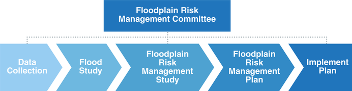
What is the Floodplain Risk Management Program? |
The Floodplain Risk Management Program is run by the NSW Government. This program helps councils make informed decisions about managing flood risk, implementing management plans to reduce flood risk and to provide essential information to the SES to deal with flood emergency response.
|
What is Flooding? |
Flooding is often associated with inundation from large rivers; however, there are other flood mechanisms that can cause inundation. The Hunters Hill LGA is primarily affected by two types of flooding; overland flow flooding and mainstream flooding.
|


What is a flood study? |
A flood study is a comprehensive technical investigation of flood behaviour. This study will define the nature of flood risk in the LGA by providing information on the extent, level and velocity of floodwaters for a full range of flood magnitudes up to and including the largest possible flood, termed the ‘Probable Maximum Flood’. |
What is a flood study used for? |
Flood studies provide key information for Council, the SES and the community and are part of the process to manage an area’s flood risk.
Information from the flood study will assist the SES in its evacuation and logistics planning. The outcomes of the study will provide the SES with:
|
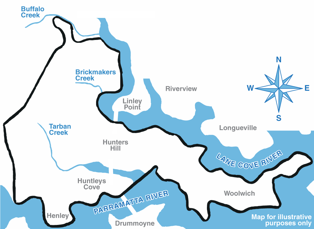
The Study Area |
The Hunters Hill LGA covers a 6 square kilometre area with two key creeks (Tarban Creek and Brickmakers Creek) that flow through the LGA and into the Lane Cove River and Parramatta River respectively. These creeks are shown in the map below.
|
Why your feedback is important |
GRC Hydro will develop computer models to determine the existing flood affectation in the area. Calibration and validation is a key phase in the development of these models. This process ensures that the modelled flood behaviour accurately reflects the flood behaviour in reality. As such, community input and knowledge of historical flood affectation is invaluable to this study.
|
How you can help us |
Your feedback is important in helping us get a complete picture of flood behaviour in your LGA and how this affects your community. Please share your experiences and knowledge with us by completing the questionnaire linked below.
|
Who can you contact for more information? |
If you have any further questions regarding the flood study or any further flood information or photos, please attach them to your questionnaire or contact the following representatives.
|

The Hunters Hill
Flood Study Questionnaire
