Have Your Say on
Flooding in Your Area
We need your knowledge on flooding in your area |
On behalf of North Sydney Council, GRC Hydro are undertaking the North Sydney Local Government Area (LGA) Floodplain Risk Management Study & Plan. We would like to hear your experiences of flooding to better understand how flooding occurs in your area and what measures may improve the current flood situation.
|
What is the Floodplain Risk Management Program? |
The Floodplain Risk Management Program, managed by the NSW Government, helps Councils make informed decisions about managing flood risk, implementing management plans to reduce flood risk and to provide essential information to the SES to deal with flood emergencies.
|
What is Flooding? |
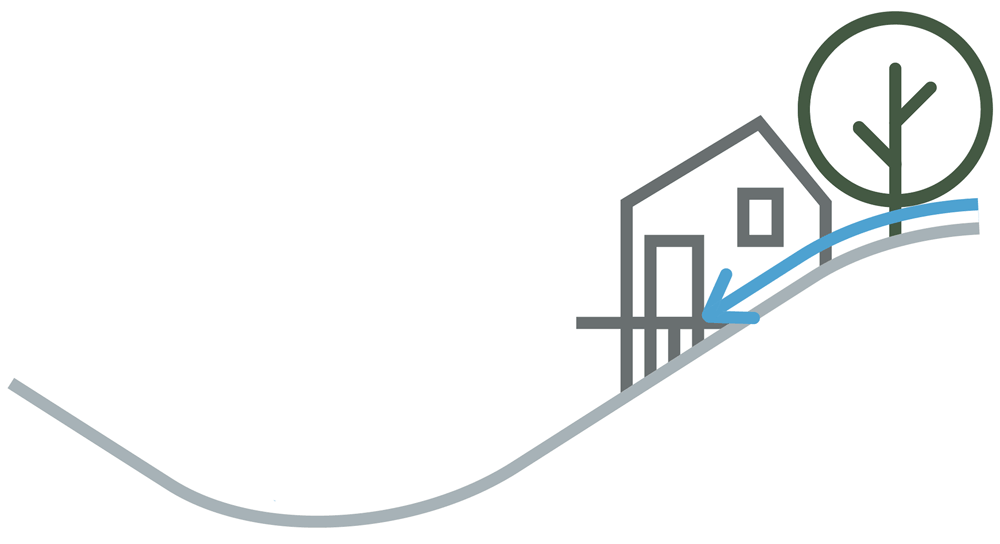
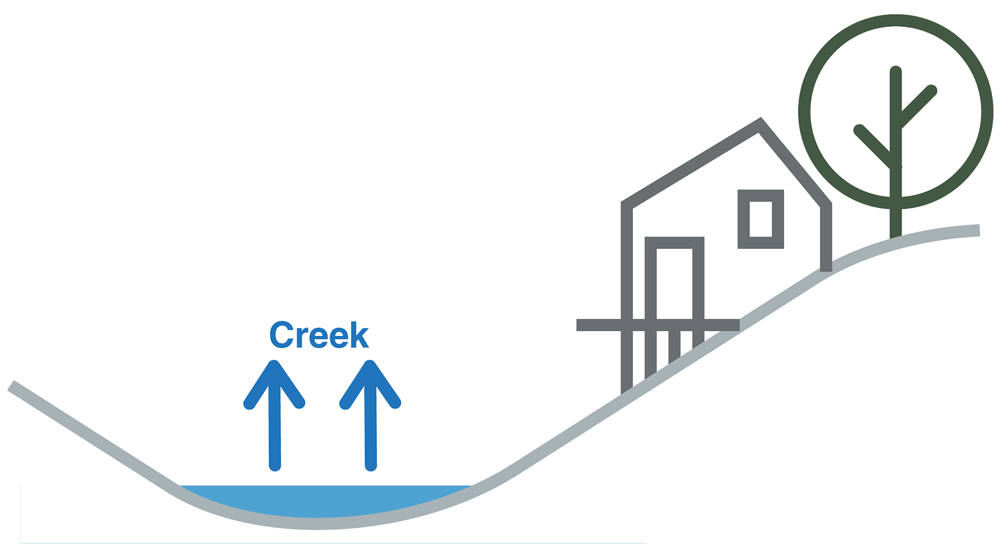
Flooding is often associated with inundation from large rivers; however, there are many different flood mechanisms that can cause inundation. The North Sydney LGA is primarily affected by two types of flooding; overland flow flooding and creek flooding.
|
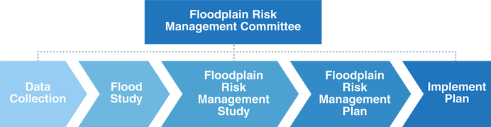
What is a floodplain risk management study and plan?
|
A Floodplain Risk Management Study and Plan draws on the results of a Flood Study to identify, assess and compare various flood risk management options. It provides information and tools to assess the flood impacts of different management options and provides a plan for the implementation of the preferred options.
|
What is a FRMS&P used for?
|
A Floodplain Risk Management Study and Plan provides key information for Council, the SES and the community for effectively managing and mitigating flood risk.
Information from the FRMS&P will assist the SES in its evacuation and logistics planning. The outcomes of the study will provide the SES with:
|
The Study Area |
The North Sydney Local Government Area covers an 11 square kilometre area with a topographic ridge running east to west sloping down toward Sydney Harbour to the south and Middle Harbour in the north. The topography creates a large number of steep catchments flowing generally north or south. The study area is shown in the map below, which shows the LGA boundary in purple along with suburbs and major roads.

|
Why your feedback is important |
GRC Hydro will be identifying areas that are significantly flood affected and assessing flood modification measures to relieve the flood risk at these locations. This involves using computer models developed in the North Sydney LGA Flood Study to assess flood mitigation measures. Community input and knowledge of measures that might mitigate flooding in the LGA is invaluable to this study.
|
How you can help us |
Your feedback is important in helping us get a complete picture of the community’s knowledge of flood behaviour and mitigation in your LGA. Please complete the questionnaire linked below to help Council better understand your experiences with flooding.
|
Who can you contact for more information? |
If you have any further questions regarding the study or any further flood information/photos please attach them in the questionnaire or contact the following representatives.
|

Please help us to better understand flooding in your area by completing the questionnaire below.