Have Your Say on
Flooding in Your Area
Tarcutta, Ladysmith and Uranquinty Floodplain Risk Management Studies & Plans
|
On behalf of Wagga Wagga City Council, GRC Hydro are undertaking Floodplain Risk Management Studies and Plans for Tarcutta, Ladysmith and Uranquinty. We would like to hear your experiences of flooding to better understand how flooding occurs in your area and what measures may improve the current flood situation.
|
What is the Floodplain Risk Management Program?
|
The Floodplain Risk Management Program is run by the NSW Government. This program helps councils make informed decisions about managing flood risk, implementing management plans to reduce flood risk and to provide essential information to the SES to deal with flood emergency response.
|
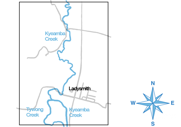
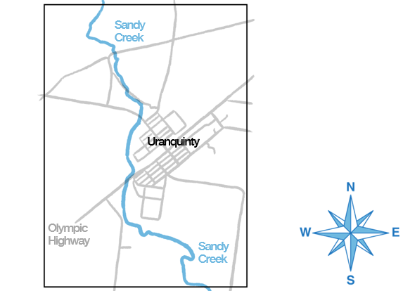
Flooding in Tarcutta, Ladysmith and Uranquinty |
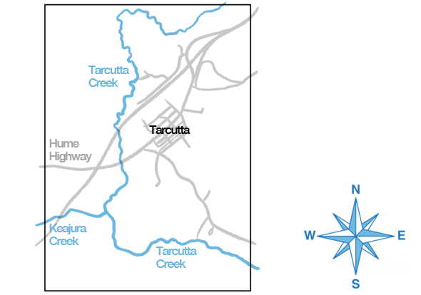
Tarcutta
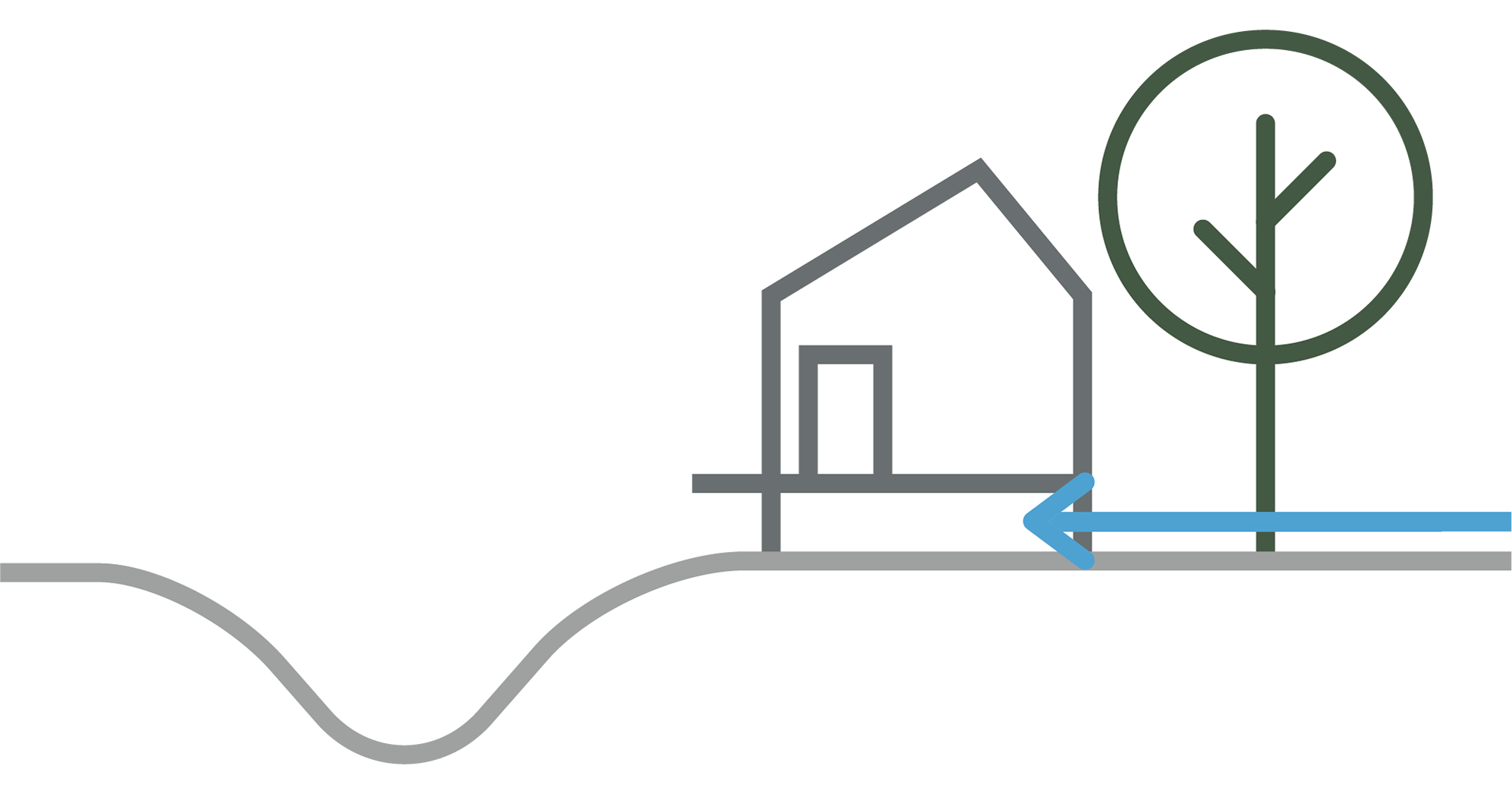
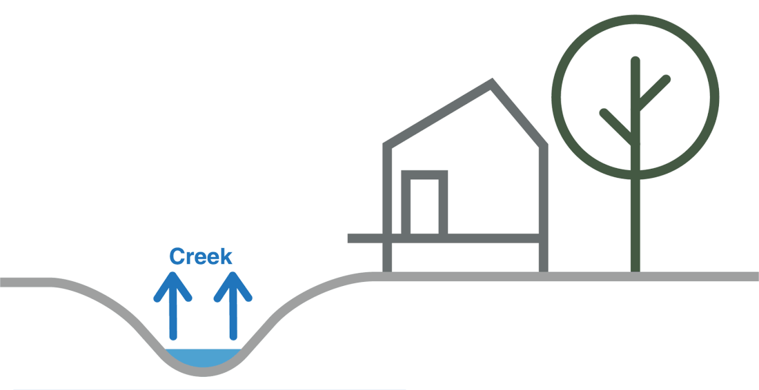
Flooding in Tarcutta is caused by heavy rainfall in the catchment of Tarcutta Creek causing it to break its banks and spread over its floodplain. There is a second source of flooding, referred to as overland flow flooding. This occurs when rainfall in the vicinity of the town causes flooding as it flows towards the creek. Mainstream and overland flow flooding can occur simultaneously, or separately.
|
Overland Flow |
|
Mainstream |
|
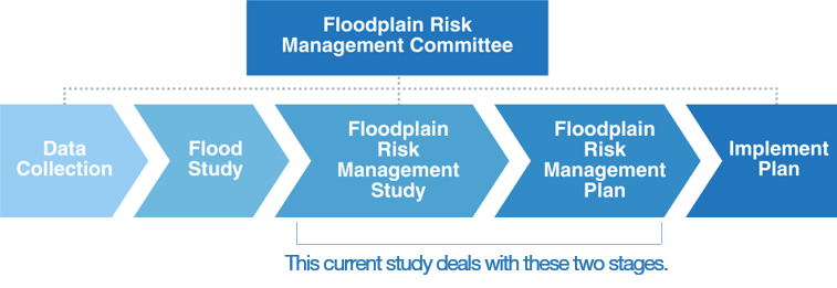
What is a floodplain risk management study and plan?
|
A floodplain risk management study and plan (FRMS&P) follows a flood study. A flood study is a comprehensive technical investigation of flood behaviour which defines the nature of flood risk in the LGA by providing information on the extent, level and velocity of floodwaters for a full range of flood magnitudes.
|
What is a FRMS&P used for?
|
A FRMS&P provides key information for Council, the SES and the community for effectively managing and mitigating flood risk.
+ Identification and assessment of floodplain risk management measures for existing development areas aimed at reducing social, environmental and economic loss of flooding on development and the community. Information from the FRMS&P will assist the SES in its evacuation and logistics planning. The outcomes of the study will provide the SES with:
+ a description of flood warning times for the LGA; and + identification of critical evacuation issues in the LGA such as locations where road access is cut and the warning time before road access is cut. |
The Study Areas |
The Tarcutta, Ladysmith and Uranquinty Flood Studies were completed in late 2014 and outcomes from the flood studies have formed the basis of the current study.
|
Why your feedback is important |
GRC Hydro will use computer models developed in the flood studies to assess flood mitigation measures. This process involves identifying areas that are significantly flood affected and assessing flood modification measures to relieve the flood risk at these locations. Community input and knowledge of measures that might mitigate flooding in the LGA is invaluable to this study.
|
How you can help us |
Your feedback is important in helping us get a complete picture of the communities knowledge of potential mitigation measures in your town. Please share your experiences and knowledge with us by completing the questionnaire linked below.
|
What happens next? |
GRC Hydro will assess flood modification measures and will present draft findings to Council’s Floodplain Management Committee. Following further discussion, the draft report containing recommended measures will be placed on Public Exhibition in 2019.
|
Who can you contact for more information? |
If you have any further questions regarding the study or any further flood information/photos please attach them to your questionnaire or contact the following representatives.
|
Please fill out just the one questionnaire that applies to your area.

|

|

|